Civic Tech Field Guide
Sharing knowledge and productively growing the field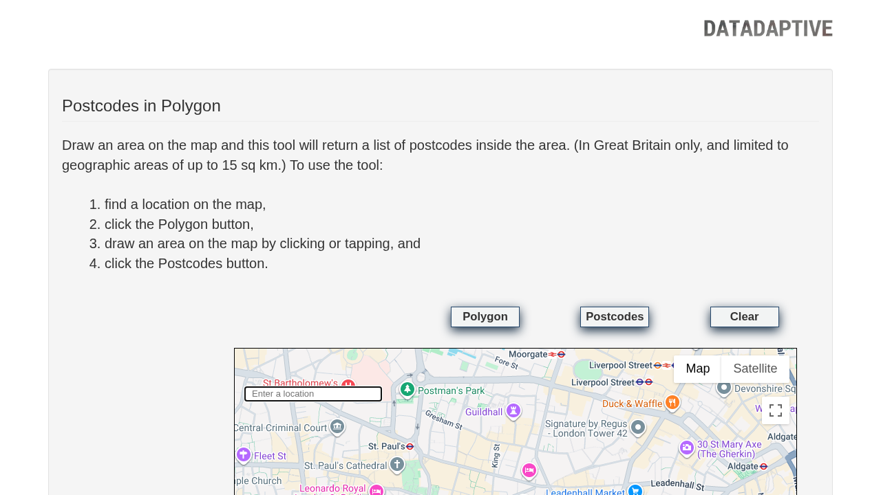
Datadaptive's Postcodes in Polygon tool allows users to draw an area on a map and retrieve a list of postcodes within that area in Great Britain, using data from the November 2024 release of the ONS Postcode Directory product
Datadaptive's Postcodes in Polygon tool allows users to draw an area on a map and retrieve a list of postcodes within that area in Great Britain, using data from the November 2024 release of the ONS Postcode Directory product.
| Status: | Active |
|---|---|
| Last Modified: | 6/2/2026 |
| Added on: | 2/21/2025 |
Project Categories
Additional Images
Get email updates
Helpful Links
Reach Out
A project of

With support from
National Endowment for Democracy
Founding Organization
Civic Hall
Technology partner

This guide and directory are free to use, re-use, adapt, and modify for non-commercial purposes as long as you link back with attribution.
 Civic Tech Field Guide
Civic Tech Field Guide